
Introduction
Heavy monsoon rains have once again put Nashik district in the spotlight, with overflowing rivers, rising dam levels, waterlogged roads, and flood alerts affecting several parts of the region. As one of Maharashtra's key districts, Nashik plays an important role in agriculture, tourism, and water resource management, making extreme weather events particularly significant.
The latest spell of intense rainfall has triggered precautionary evacuations, road closures, and controlled water releases from major dams, while authorities continue monitoring the situation closely. For residents, travelers, farmers, and businesses, staying informed is essential during such rapidly changing weather conditions.
In this article, we'll examine the latest Nashik district flood situation, explore the causes behind the flooding, assess its impact, explain the role of dams and the monsoon, and discuss safety measures for affected communities.
Nashik District Floods: Latest Situation
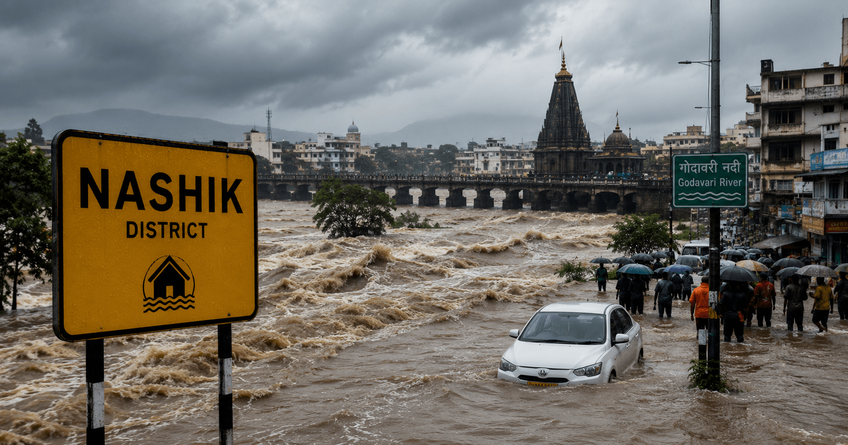
Heavy rainfall across Nashik district has led to flood alerts in several areas. Authorities have reported overflowing streams, inundated low-lying locations, road closures, and precautionary evacuations in vulnerable regions.
Among the most affected areas are parts of Surgana, Malegaon, and downstream stretches of the Godavari River, where rising water levels prompted emergency response measures.
Why Is Nashik Experiencing Flooding?
Several factors have combined to create flood-like conditions.
Intense Monsoon Rainfall
Continuous heavy rainfall over multiple days has rapidly increased river flows and runoff across the district.
According to district rainfall updates, catchment areas have received significant precipitation during the recent monsoon spell.
Rising River Levels
The Godavari River, which originates near Trimbakeshwar in Nashik district, has experienced a substantial rise in water levels due to heavy upstream rainfall and dam releases.
Low-lying settlements near riverbanks remain particularly vulnerable during such periods.
Dam Water Releases
Heavy inflows have rapidly increased storage in several reservoirs across the district.
To maintain dam safety, authorities initiated controlled water releases from multiple reservoirs, including the Gangapur Dam, contributing to higher downstream river flows.
Areas Affected by the Flood Situation
Several regions have experienced varying levels of disruption.
Major Impacted Areas
- Surgana Taluka
- Malegaon
- Godavari riverbanks
- Low-lying villages
- Downstream areas of Gangapur Dam
- Several rural road networks
Authorities continue monitoring conditions as rainfall persists.
Impact on Transportation
Floodwaters have significantly affected transportation.
Reports indicate:
- Multiple roads temporarily closed
- Waterlogging on important routes
- Restricted movement in flood-prone villages
- Increased travel delays
Residents have been advised to avoid unnecessary travel until conditions improve.
Human Impact
Sadly, the heavy rainfall has also resulted in casualties.
Officials reported that a farmer in Surgana was swept away while attempting to cross an overflowing stream. In addition, families in flood-affected areas such as Malegaon were evacuated as a precaution after rising river water entered residential areas.
Reservoir Levels Continue to Rise
One of the biggest developments has been the rapid increase in reservoir storage.
Recent updates show:
- Reservoir storage has risen sharply after continuous rainfall.
- Controlled releases have begun from multiple dams.
- Gangapur Dam storage increased substantially, improving long-term water availability while requiring careful downstream management.
How Authorities Are Responding
District administration and emergency agencies have taken several precautionary measures.
Flood Alerts
Authorities issued alerts for residents living in low-lying and riverside areas.
Evacuations
Families from vulnerable locations have been shifted to safer places where necessary.
Traffic Management
Road closures and diversions have been implemented to reduce risks.
Continuous Monitoring
Water levels in rivers and reservoirs are being monitored around the clock to guide operational decisions.
Safety Tips During Floods
Residents should follow official advisories and take practical precautions.
Flood Safety Checklist
- Avoid crossing flooded roads or streams.
- Stay away from riverbanks and dam discharge zones.
- Keep emergency supplies ready.
- Charge mobile devices and power banks.
- Follow updates from the district administration and IMD.
- Evacuate immediately if instructed by authorities.
- Avoid driving through waterlogged roads.
Preparedness can significantly reduce the risk of injury during flood events.
The Role of Climate Change
Experts suggest that climate change is increasing the frequency of intense rainfall events across many parts of India.
Although no single flood event can be attributed solely to climate change, warmer atmospheric conditions can contribute to heavier rainfall episodes, making flood preparedness increasingly important.
What This Means for Agriculture
Nashik is a major agricultural district known for:
- Grapes
- Onions
- Tomatoes
- Pomegranates
- Sugarcane
While rainfall supports farming, excessive flooding can damage crops, delay harvesting, erode soil, and affect rural livelihoods.
Future Flood Management in Nashik
Several measures can strengthen long-term resilience.
Better Early Warning Systems
Improved forecasting and real-time alerts can help communities prepare sooner.
Smart Reservoir Management
Coordinated dam operations can reduce downstream flood risks while preserving water resources.
Urban Drainage Improvements
Modern drainage infrastructure can reduce waterlogging in towns and cities.
Public Awareness
Community education and emergency preparedness remain critical for minimizing flood impacts.
Frequently Asked Questions (FAQs)
Why are floods occurring in Nashik district?
Heavy monsoon rainfall, rising river levels, and controlled releases from reservoirs have contributed to the current flood situation.
Which river is most affected?
The Godavari River has seen significant increases in water levels following heavy rainfall and dam discharges.
Why is water being released from dams?
Controlled releases are carried out to maintain dam safety when reservoir storage rises rapidly after heavy rainfall.
Are authorities evacuating residents?
Yes. Precautionary evacuations have been conducted in vulnerable areas where floodwaters threatened homes.
Conclusion
The Nashik district floods serve as a reminder of both the power of the monsoon and the importance of preparedness. While heavy rainfall has replenished reservoirs and improved long-term water availability, it has also brought significant challenges, including flooding, road closures, evacuations, and risks to life and property.
Looking ahead, stronger early warning systems, improved flood-resilient infrastructure, smarter reservoir management, and greater public awareness will play a crucial role in reducing the impact of future flood events. As weather patterns become more unpredictable, collaboration between government agencies, scientists, and local communities will be essential for building a safer and more resilient Nashik.
What are your thoughts on the current flood situation in Nashik district? Have you experienced the monsoon in the region or witnessed its impact? Share your views in the comments below, and don't forget to share this article with friends and family. Follow our blog for the latest updates on weather, climate, technology, and current affairs.


.png)