
Introduction
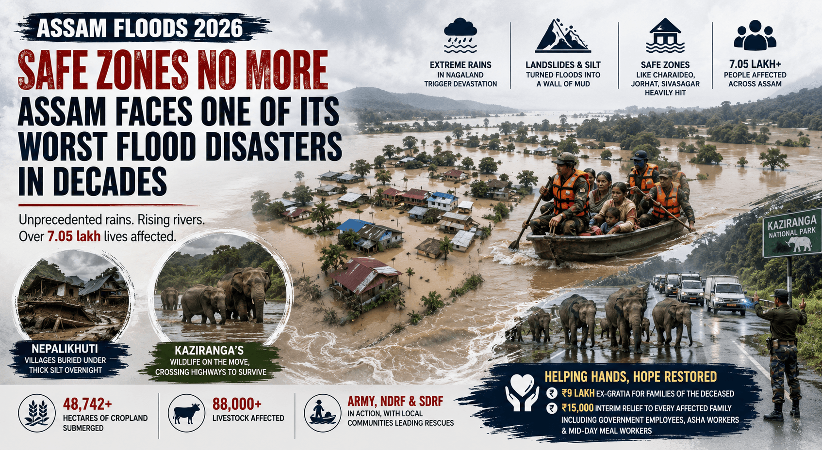
Every monsoon season, Assam faces one of India's most challenging natural disasters—flooding. In 2026, heavy rainfall, swollen rivers, and overflowing tributaries once again affected several districts, disrupting daily life, damaging infrastructure, impacting agriculture, and forcing thousands of people to seek safer locations. Authorities, disaster-response agencies, and local communities have been working together to provide rescue, relief, and rehabilitation while monitoring the evolving flood situation.
The recurring floods highlight both Assam's unique geography and the urgent need for long-term flood resilience. In this article, we explore the causes of the Assam Flood 2026, the districts affected, the response from government agencies, the role of technology in flood management, and the future of disaster preparedness.
Why Is Assam So Prone to Floods?
Assam's geography makes it one of India's most flood-prone states.
Several factors contribute to frequent flooding:
- The mighty Brahmaputra River and its numerous tributaries
- Intense monsoon rainfall across Northeast India
- Water flowing from the surrounding Himalayan catchments
- Riverbank erosion
- Sediment deposition that raises riverbeds over time
- Localized heavy rainfall and flash floods
According to the Government of Assam, nearly 40% of the state's land area is flood-prone, making floods a recurring natural hazard.
Assam Flood 2026: What Happened?
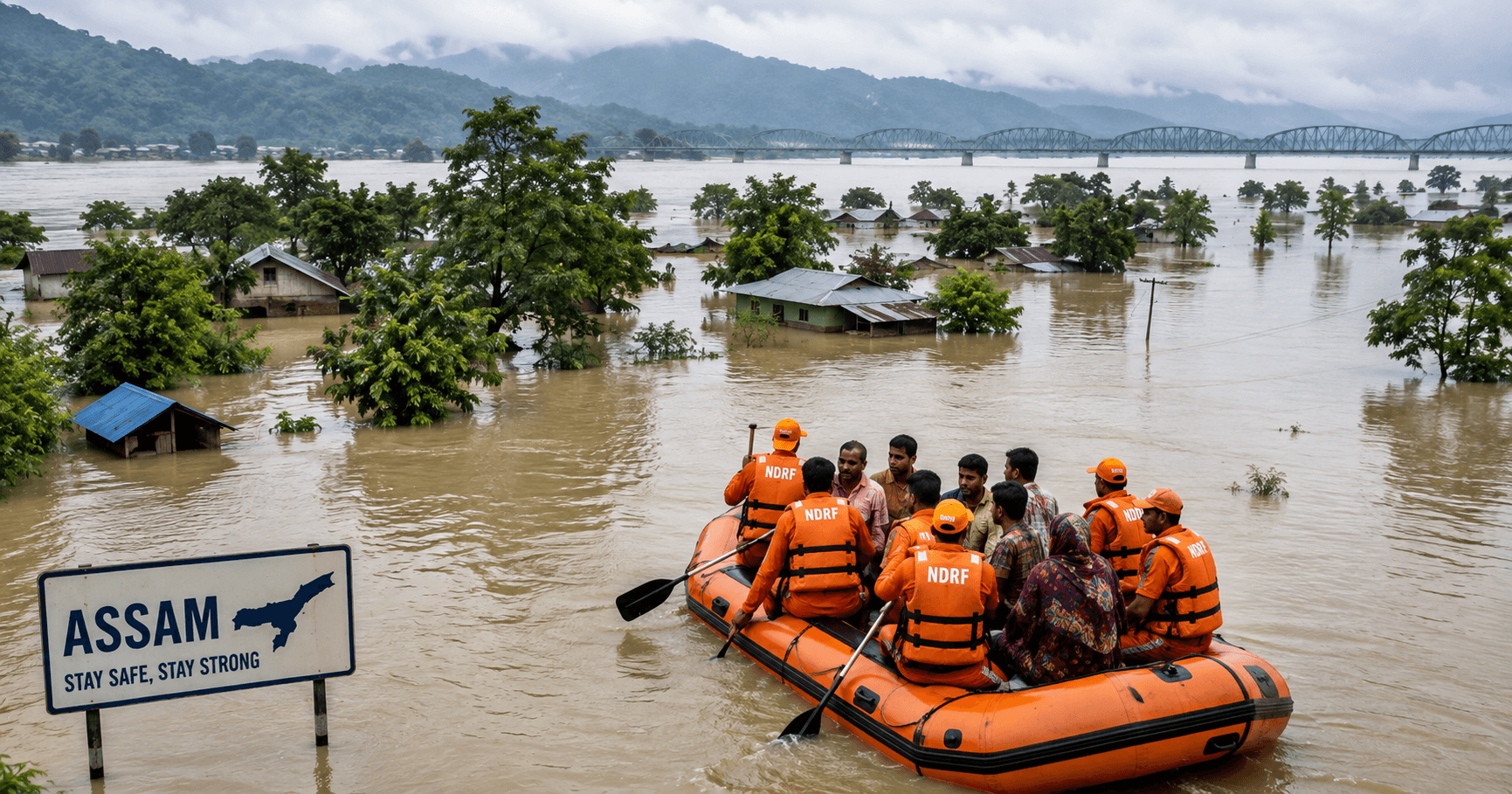
During the 2026 monsoon season, prolonged rainfall caused rivers in several districts to rise above danger levels, leading to widespread inundation. Rescue teams, district administrations, and disaster management authorities deployed boats, relief camps, medical assistance, and emergency supplies for affected communities. State authorities also carried out continuous field assessments and coordinated relief operations.
Because flood conditions change daily, readers should refer to the official Assam State Disaster Management Authority (ASDMA) flood reports for the latest verified situation.
Major Causes Behind the 2026 Floods
1. Heavy Monsoon Rainfall
Persistent rainfall across Assam and upstream catchment areas increased river discharge significantly.
2. Rising River Levels
The Brahmaputra and several tributaries crossed warning or danger levels in different locations, resulting in inundation of nearby settlements.
3. Riverbank Erosion
Floodwaters accelerate erosion, threatening homes, farmland, and infrastructure.
4. Low-Lying Terrain
Large parts of the Brahmaputra Valley are naturally susceptible to seasonal flooding.
Impact of Assam Flood 2026
Floods affected multiple aspects of life.
Human Impact
Many families experienced displacement, requiring temporary shelters and relief assistance.
Agriculture
Floodwaters damaged cropland, affecting farmers and local livelihoods.
Infrastructure
Roads, bridges, schools, and public utilities experienced varying degrees of disruption.
Wildlife
Protected areas, including those connected to Assam's rich biodiversity, often face challenges during severe floods as wildlife moves to higher ground.
Government Response and Relief Measures
Several agencies have been actively involved in response efforts:
- Assam State Disaster Management Authority (ASDMA)
- District administrations
- State government departments
- National Disaster Response Force (NDRF)
- State Disaster Response Force (SDRF)
- Health departments
- Local volunteers and community organisations
Measures included:
- Rescue operations
- Relief camp management
- Distribution of food and drinking water
- Medical assistance
- Continuous monitoring of river levels
- Damage assessment and rehabilitation planning
Insurance regulators also directed insurers to expedite eligible flood-related claims in affected districts to help impacted policyholders.
Technology Helping Fight Floods
Modern flood management increasingly relies on technology.
Important tools include:
Satellite Monitoring
Satellite imagery helps monitor flood extent and assess damage.
River Gauge Networks
Real-time river level monitoring supports timely alerts.
Weather Forecasting
Meteorological agencies provide rainfall forecasts that support preparedness.
Digital Flood Bulletins
Daily flood reports issued by Assam authorities help citizens stay informed.
Safety Tips During Floods
If you live in a flood-prone area:
- Follow official evacuation orders.
- Monitor government weather and flood bulletins.
- Avoid driving through floodwaters.
- Keep an emergency kit with water, medicines, food, and important documents.
- Switch off electricity if instructed.
- Drink safe or treated water.
- Stay away from damaged power lines.
Long-Term Solutions for Flood Management
Experts suggest several long-term measures:
River Management
Improving embankments and river training where appropriate.
Better Forecasting
Using advanced weather models and satellite data for earlier warnings.
Flood-Resilient Infrastructure
Designing roads, bridges, and public buildings to withstand flooding.
Community Preparedness
Increasing awareness through training, mock drills, and local disaster plans.
Environmental Conservation
Protecting wetlands, forests, and natural floodplains that help absorb excess water.
Frequently Asked Questions (FAQs)
Why does Assam experience floods every year?
Assam's location in the Brahmaputra Basin, combined with intense monsoon rainfall, river overflow, and erosion, makes annual flooding common.
Which river is mainly responsible for flooding?
The Brahmaputra River and many of its tributaries are the primary contributors to seasonal flooding.
Who monitors flood situations in Assam?
The Assam State Disaster Management Authority (ASDMA), the Water Resources Department, the India Meteorological Department (IMD), and district administrations monitor and publish official updates.
Can floods in Assam be prevented completely?
Complete prevention is unlikely because of the state's geography. However, improved forecasting, resilient infrastructure, river management, and preparedness can significantly reduce the impact.
The Future of Flood Management in Assam
The future of flood resilience in Assam will depend on combining scientific forecasting, satellite technology, stronger infrastructure, community participation, and sustainable river-basin management. Advances in remote sensing, artificial intelligence, and real-time hydrological monitoring are expected to enhance early warning systems and improve emergency response.
Building resilience requires not only engineering solutions but also environmental conservation and coordinated action among governments, researchers, and local communities.
Sources (Verified & Authoritative)
- Assam State Disaster Management Authority (ASDMA) – Daily flood reports and official situation updates.
- Water Resources Department, Government of Assam – Daily Flood Bulletin, Flood Information System, and river-level monitoring.
- India Meteorological Department (IMD) – Weather forecasts and rainfall advisories.
- Central Water Commission (CWC) – River-level observations and flood forecasting.
- National Disaster Management Authority (NDMA) – Flood preparedness and disaster management guidelines.
- Recent verified news coverage on the 2026 Assam floods and relief operations.